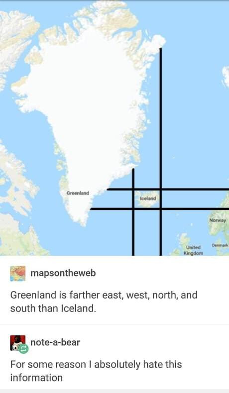
Obligatory:


Obligatory:

Wow. WOW!
I’m at a GIS conference where I’m learning how to make images like these.
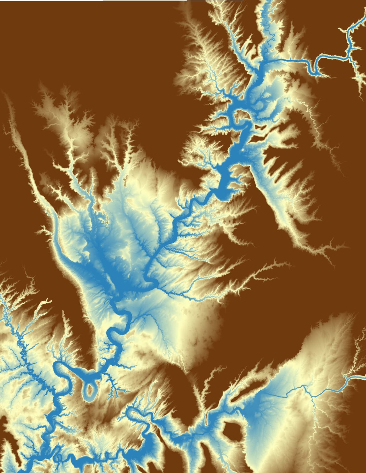
Arkansas River, SE Kansas. Ms. Shiv’s grandparents’ farm is in this frame.
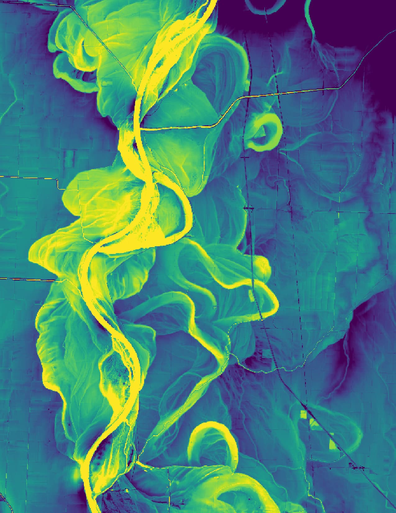
Missouri River north of Omaha (41.615, -96.085):
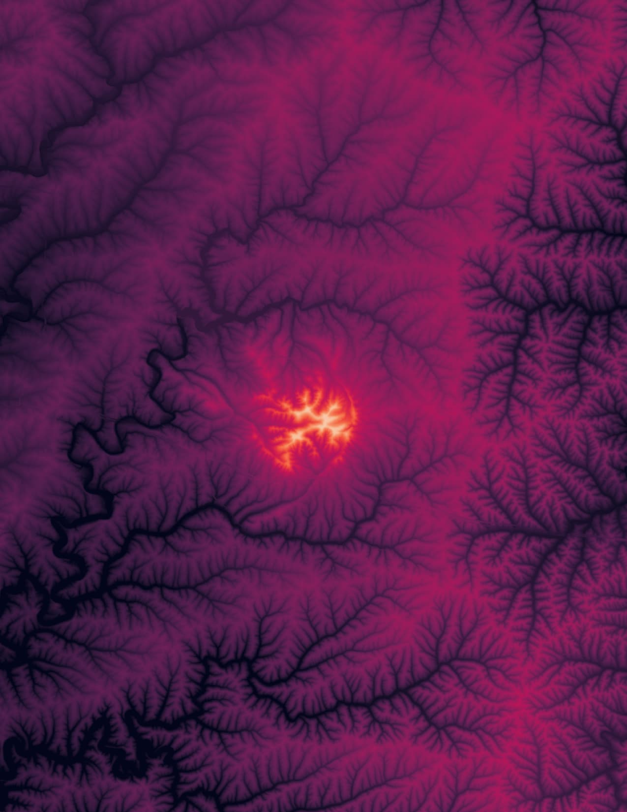
Looks like one of those scans of bloodflow in the brain
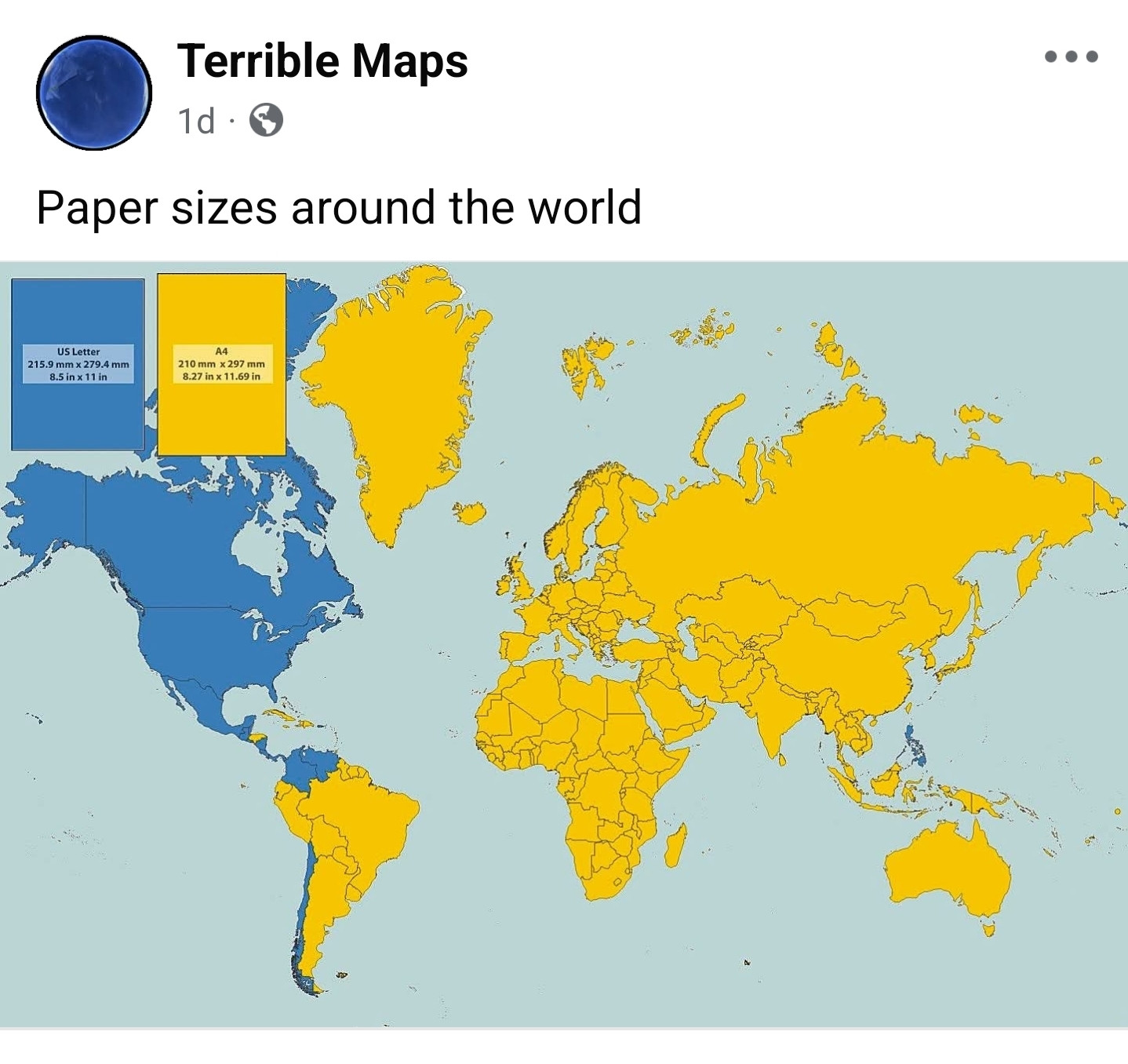
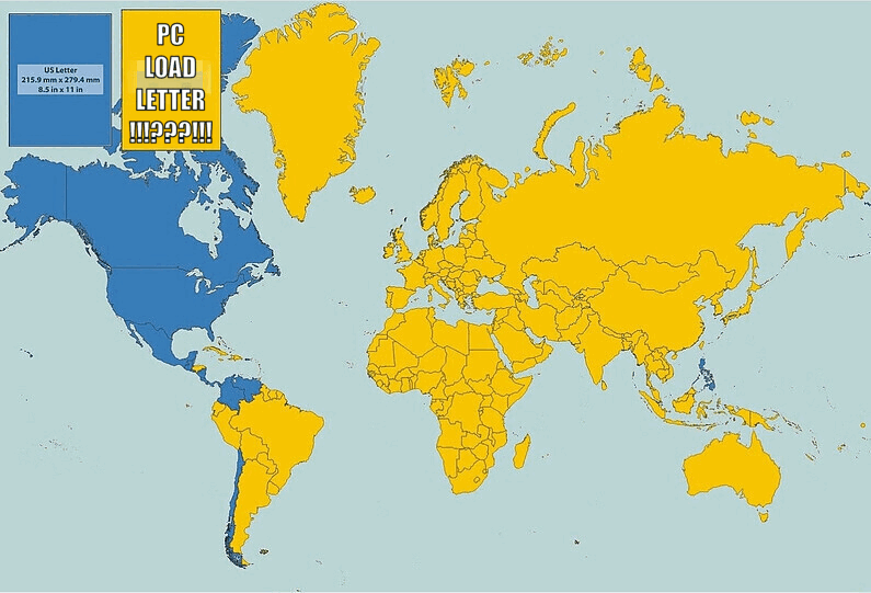
US letters are wrong.

A few more, with context.
Part of Lake Powell:
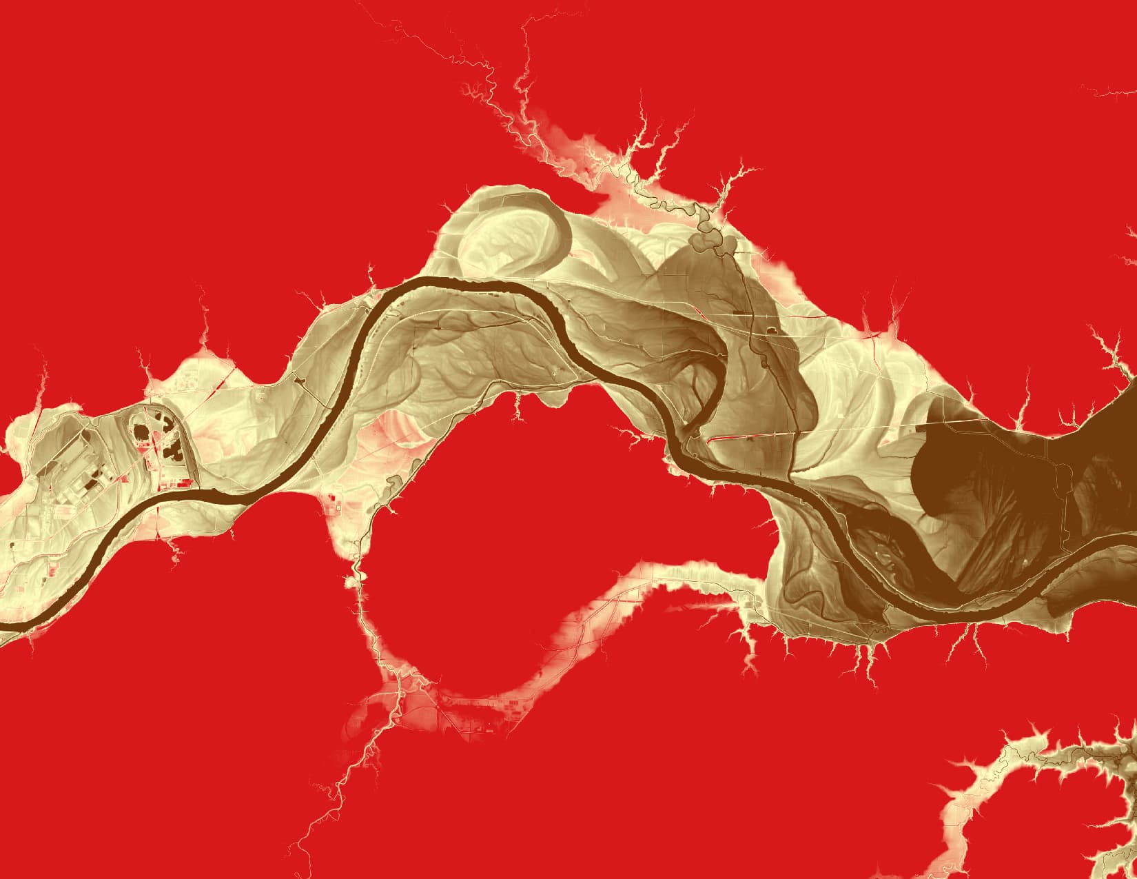
Missouri River near Kansas City:
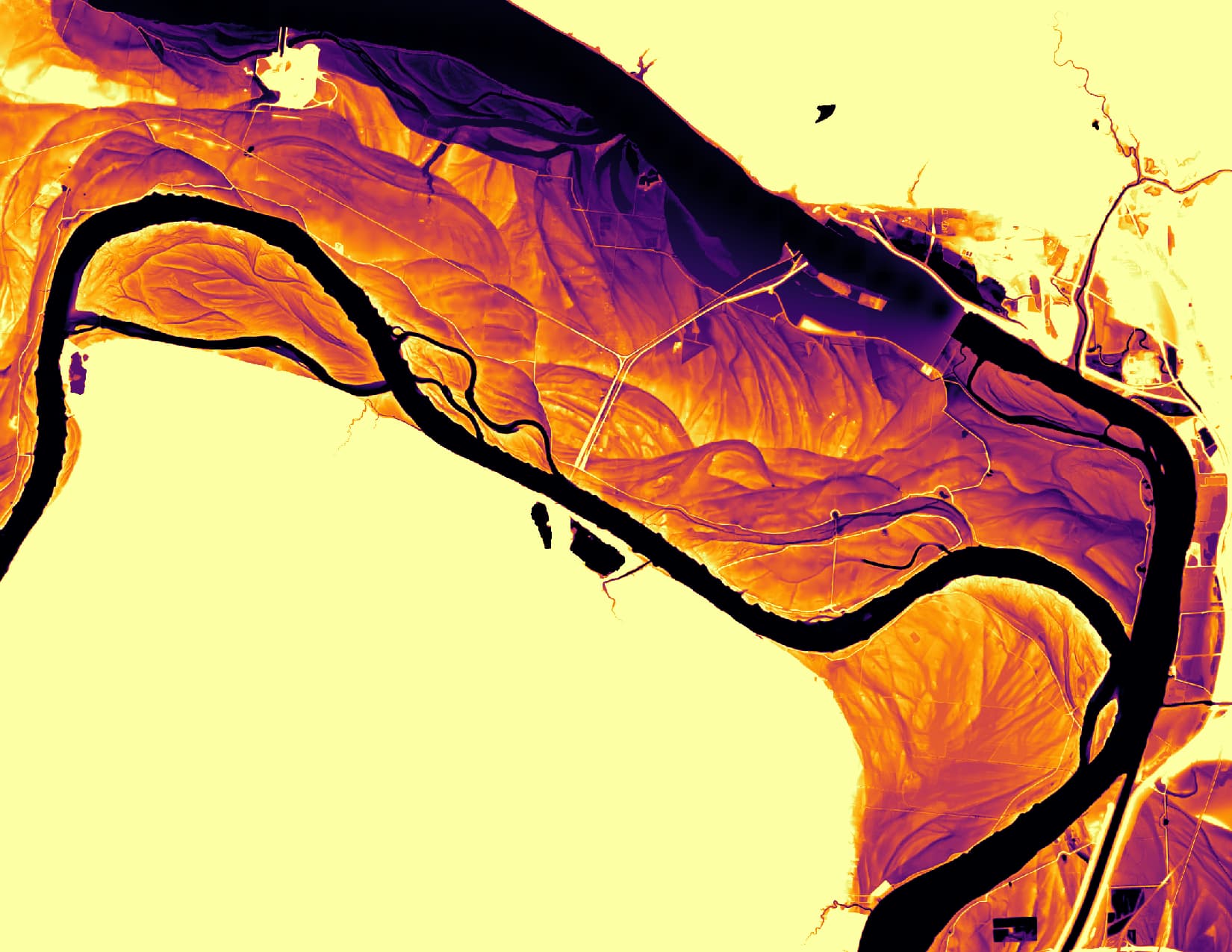
St. Charles area, with Missouri and Mississippi rivers:
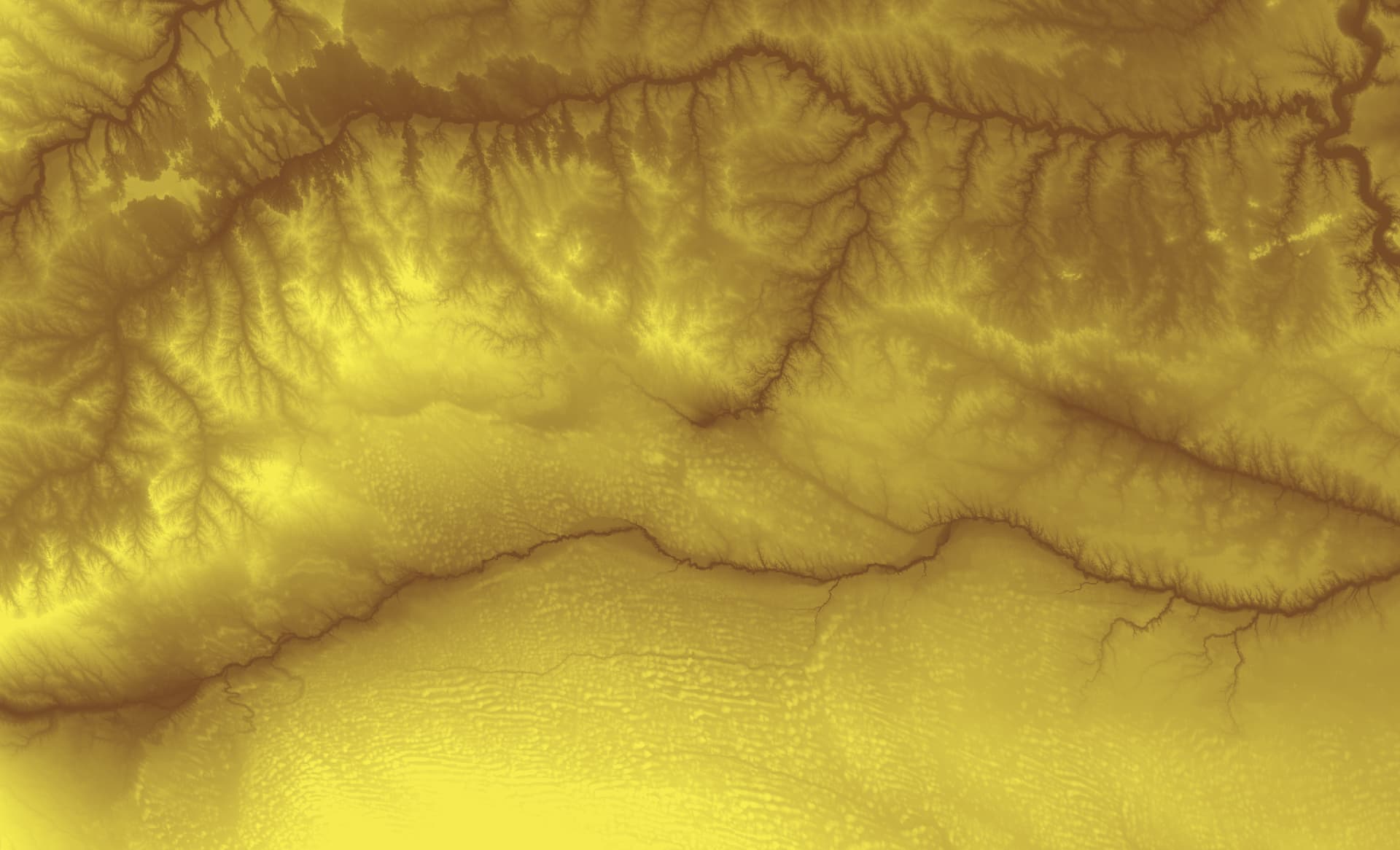
Northern part of the Sand Hills, with Niobrara and White rivers (NE and SD):
Want me to do your favorite river? Message me with the area. I can do this for any part of the earth that has lidar or DEM data available
These are beautiful images, certainly worthy of gracing a wall!
I’d love to see the Detroit River, and I bet the Ohio near Louisville would look really cool.
ETA
Ooops. Supposed to be a DM. Sorry ![]()
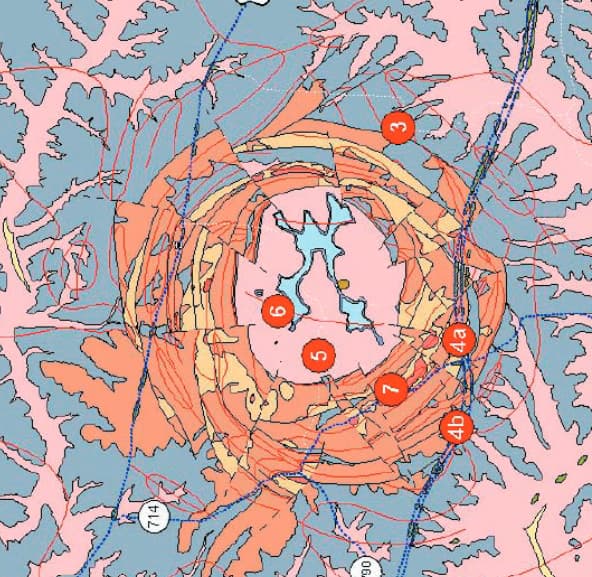
Close-up of the Ohio Falls area. The large fuzzy dots in the river are an artifact of the sampling process. They would not normally be visible, except that there’s a big drop in the river surface level there. You can see it in the raceway for the hydro plant there.
More interesting to me was this feature east of Louisville:
I looked it up. This is called Jeptha Knob, and is possibly an impact structure.
I didn’t do Detroit, because I couldn’t easily source elevation data for the Canadian side.
Thanks so much! I knew it would look cool! Love that U found that possible impact crater!!!
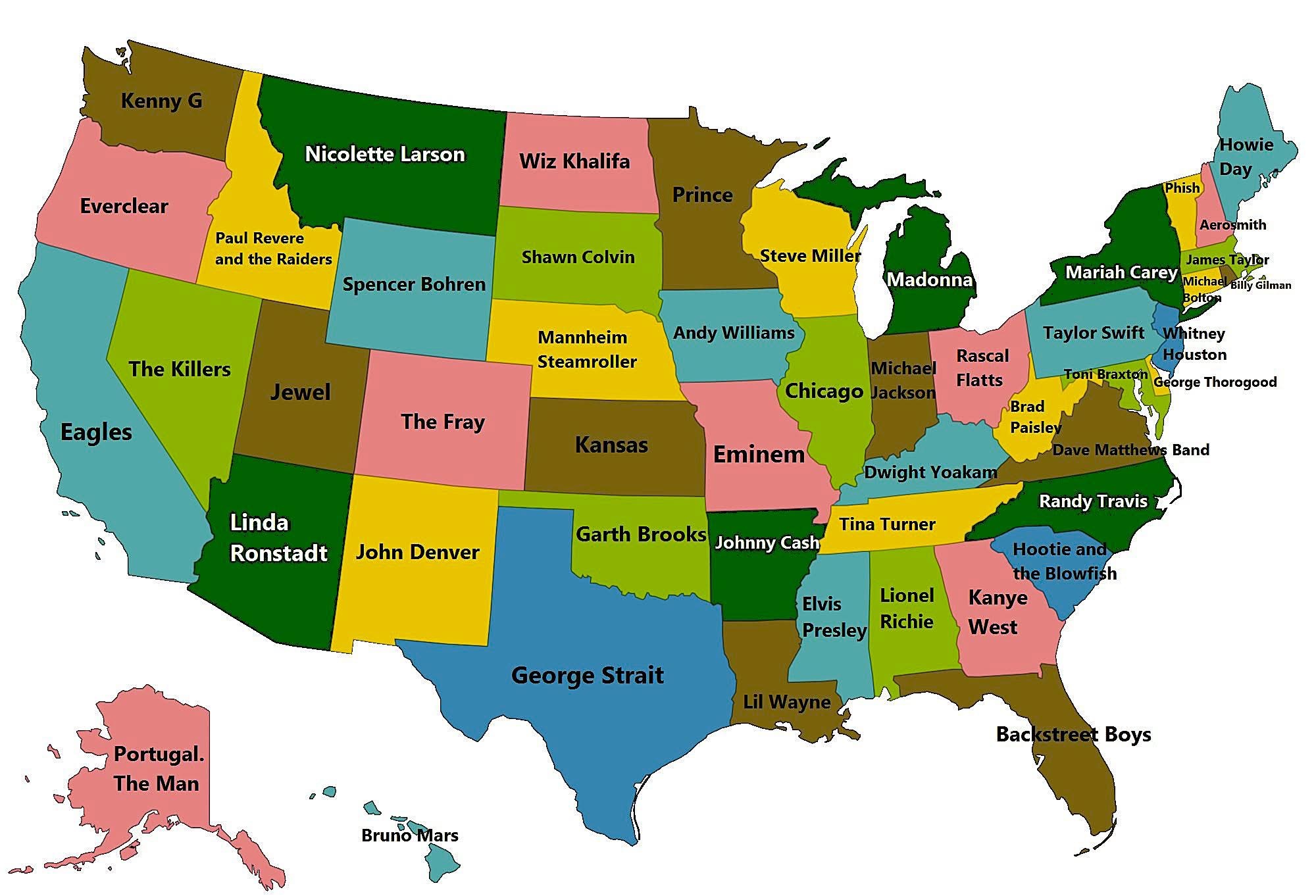
“This is a Map of the Highest Grossing Music Artists / Bands from each US State. The US State Kansas is the only one that is still labeled correctly.”