10 Likes

14 Likes
14 Likes
Gee, thanks, just what I need - another time sink.
![]()
Neat!
13 Likes
12 Likes
16 Likes
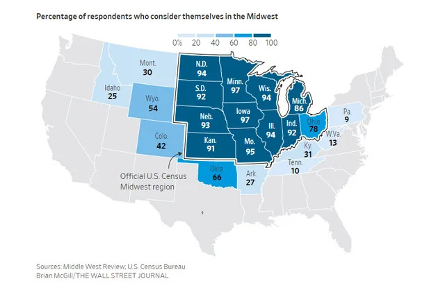
As a census data expert, I feel compelled to point out here that the Census Bureau’s Midwest Region is an administrative area (one of four such) and not some “official” designation of where the Midwest is supposed to be.
@mindysan33 eyerolled me over at the old place for making the same pedantic observation re one of her posts. Nevertheless, I stand behind my pedantry when it comes to anything census-related.
14 Likes
But there isn’t anyone with a more authoritative definition than the people whose job it is to keep track of everything, and it looks like it lines up perfectly with states where more than 75% of respondents consider themselves in the Midwest, so it still provides a pretty good standard for what the term means.
11 Likes
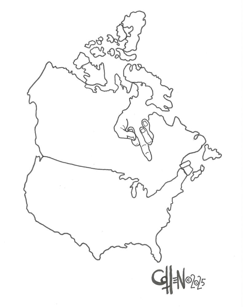
Looks like it was drawn by Mœbius.
9 Likes
True!
6 Likes
What intrigues me is that there are almost 25% of Ohio residents who don’t think they’re in the Midwest. What name would they use instead?
8 Likes
Hell?
I keed, I keed! Is beautiful state!
8 Likes
Presumably they count themselves as part of the Northeast? I mean, this is how the name Midwest is used by convention, but it has been a long time since there was anything obviously “west” about Ohio.
8 Likes
We’re hearing all about the Australian election in the news threads today, so I thought I’d point out how the results maps show just how uneven the Australian population distribution is:
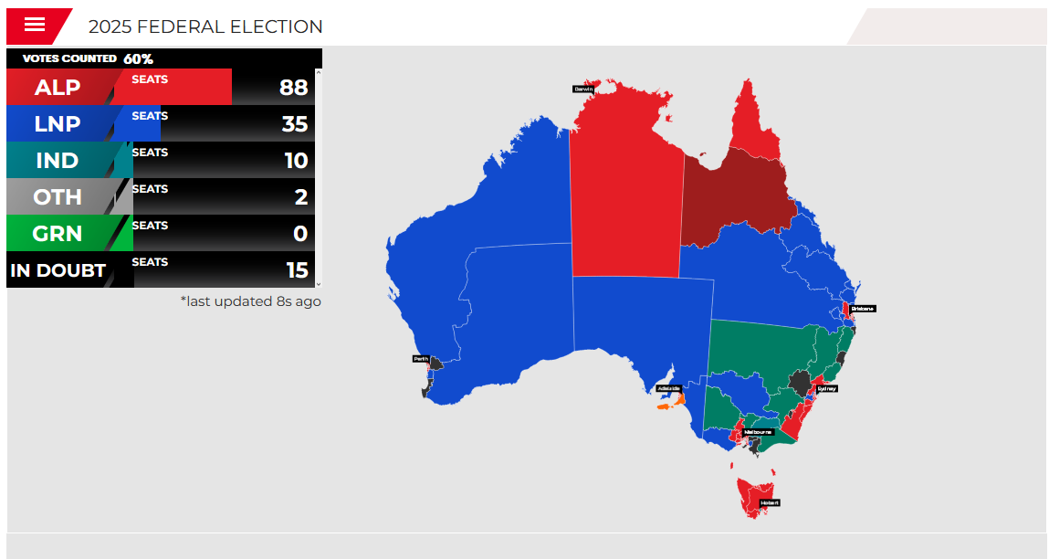
And here’s an equal area map of the same result:

The difference is immediately apparent, it’s obvious that land doesn’t vote (anymore), and the shape of the equal area cartogram is barely recognisable as Australia.
13 Likes
I wonder how the answers had turned out if the question had been “Do you consider yourself in a flyover state?”
8 Likes
And a full quarter of Idahoans consider themselves to be in the Midwest. Have they never looked at a map?
Obviously “Midwest” is a vague concept that means different things to people – another reason to eschew bogus “official” designations.
10 Likes
West:
The western theater of the American Civil War encompassed major military operations in the states of Alabama, Georgia, Florida, Mississippi, North Carolina, Kentucky, South Carolina and Tennessee, as well as Louisiana east of the Mississippi River. Operations on the coasts of these states, except for Mobile Bay, are considered part of the lower seaboard theater.[1] Most other operations east of the Appalachian Mountains are part of the eastern theater. Operations west of the Mississippi River took place in the trans-Mississippi theater.
They left out the Midwest or Old Northwest because there was much less fighting there.
10 Likes