Not a map, but can’t resist:

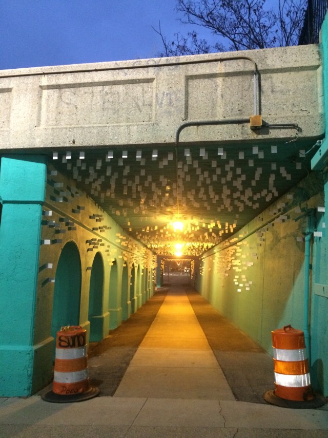
This is the RR overpass on Trumbull Ave in Detroit, N of the westbound Ford Fwy (I-94)

This is the SB approcah:

Not a map, but can’t resist:
This is the SB approcah:
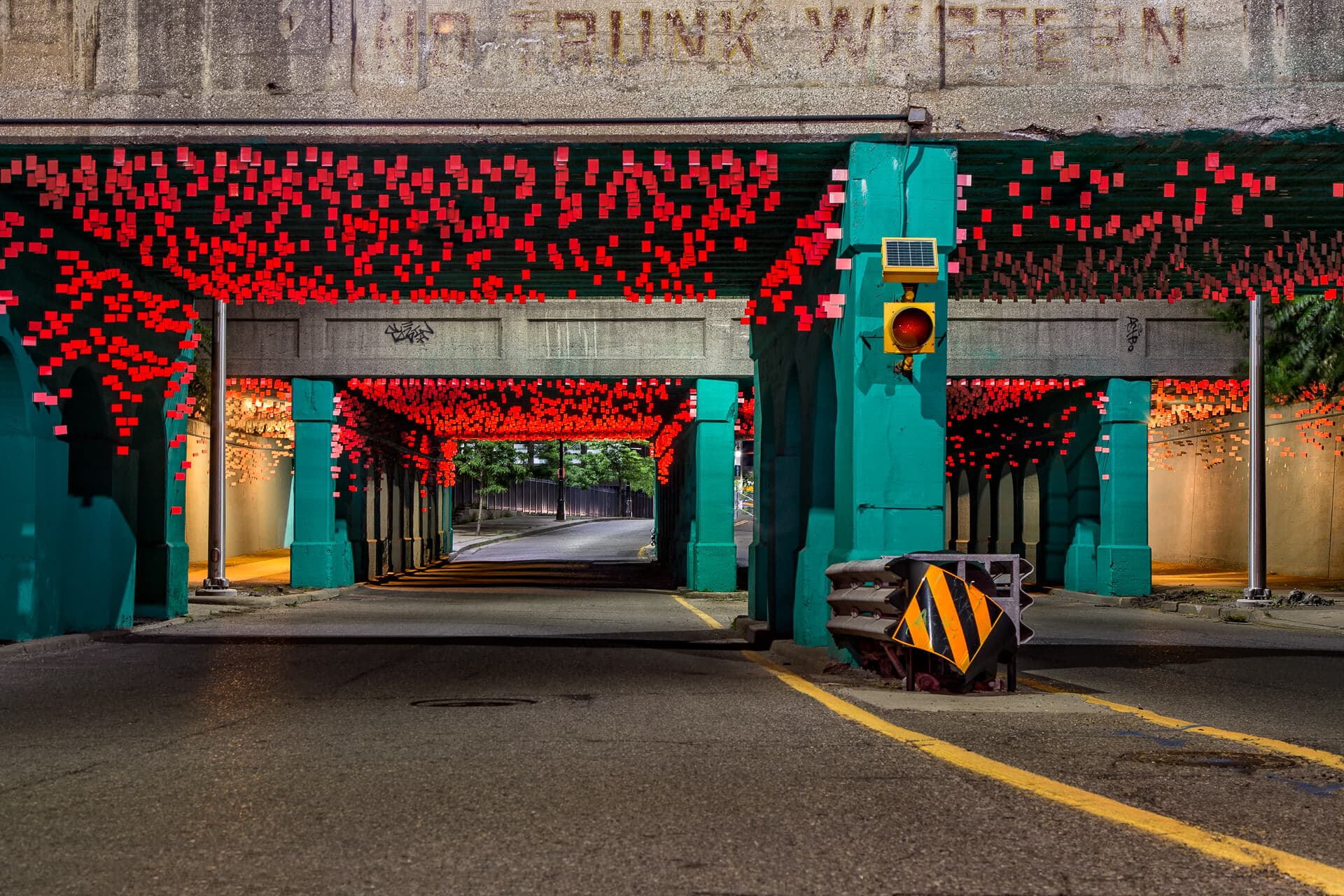
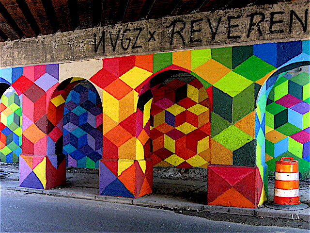
If it’s one thing I love, it’s beautiful art in random places! ![]()
An art project was granted access to three RR bridges further N of there.
Cass Ave
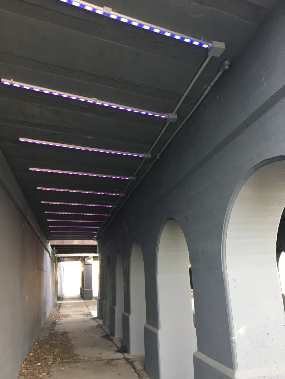
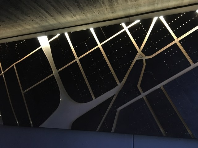
A groovily lit map of Detroit, under the Second Ave bridge


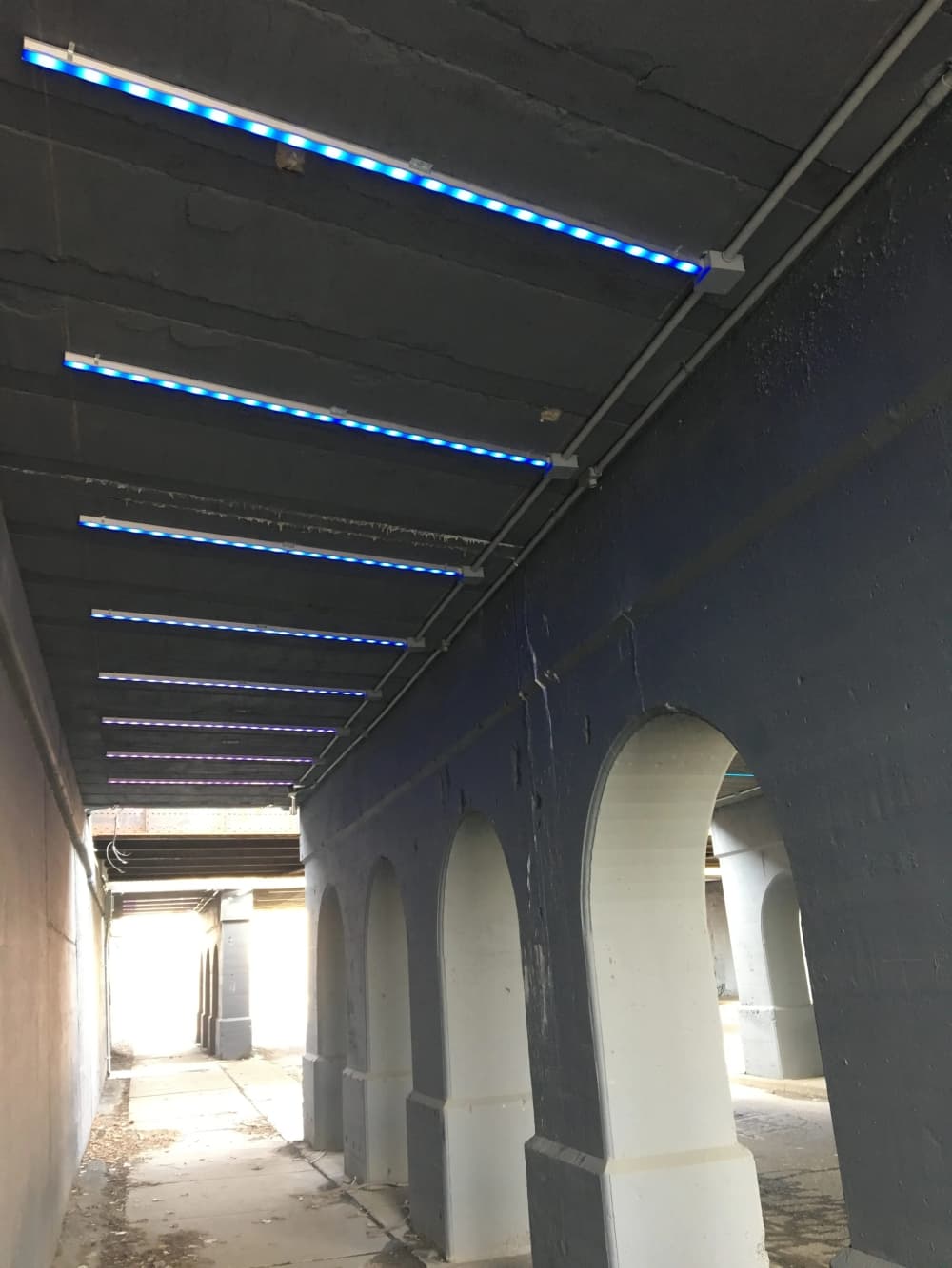
Interactive lights, Third Ave


Too much missing data!
Fake news. Should be nothing but ![]() .
.
One would certainly think so, but I’ve read sooo many horrid stories re: drunken holidaying Brits in Spain!
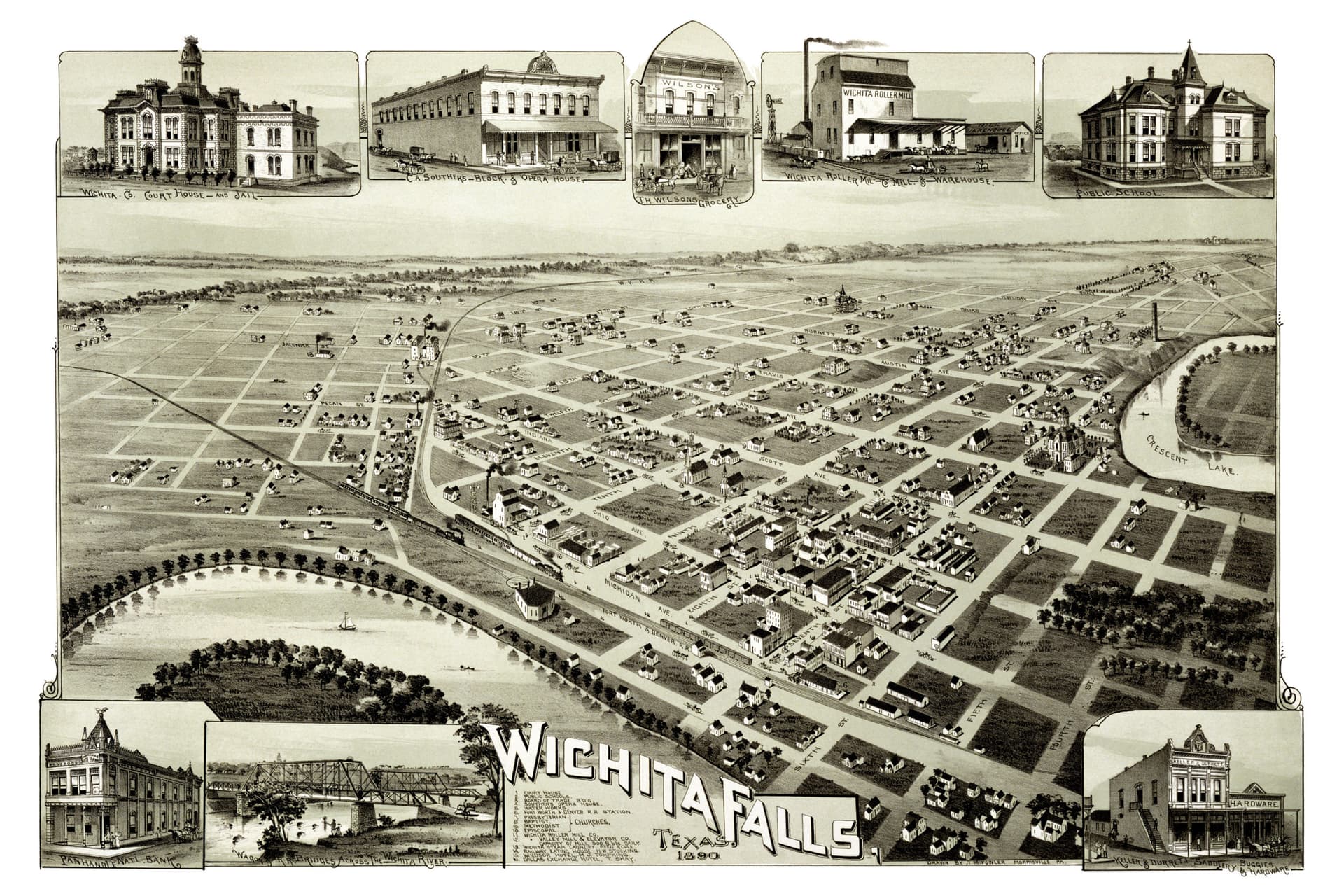
No idea, but I have a map just like that hanging in my living room of ATL… it certainly reflects how people would have been able to view a city by going to a high point and drawing what they saw?
A hypothetical high point, maybe. There’s definitely no high point to give that kind of a view of Wichita Falls. But I like those kind of maps. They’re fun to look at. Like that lake in the upper right, Crescent Lake. I was born and grew up in Wichita Falls and I’ve never heard of that lake, and there’s no lake there. Apparently it dried up long before I was born. But those streets are all still there. Mostly with the same names.
Possibly could’ve used a hot air balloon, and done a quick sketch of the landscape to refine later.
Yeah definitely… The location of the “high point” on the ATL map doesn’t exist… there is sort of a high point where the capitol building is, but it’s not that high. I guess it might have looked different prior to the building of high rises downtown…
Me too. I’m sure someone has written a history of those kinds of maps, but it’s not my field, so I couldn’t tell ya.
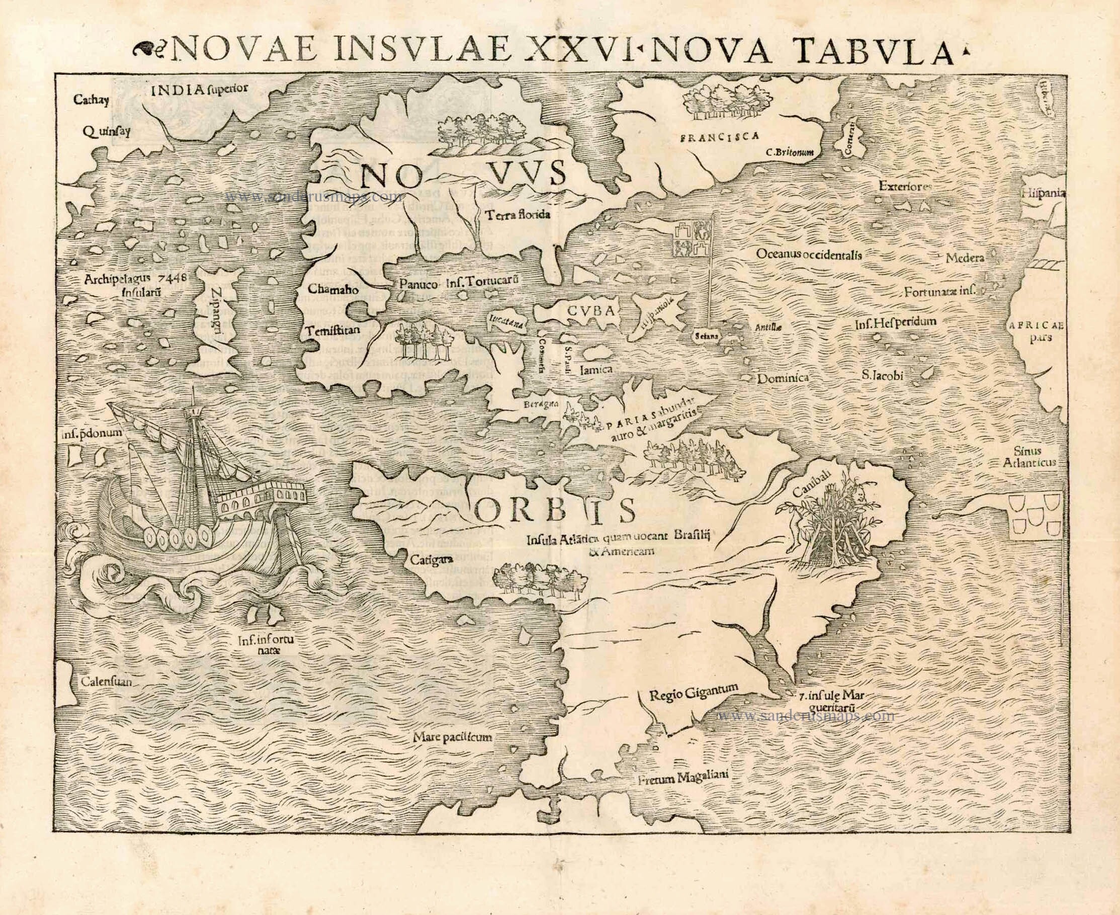
America by Sebastian Münster - 1555
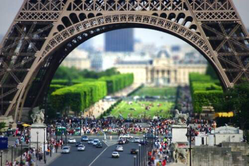
Tilt shift?
“Isometric”

Australian tourons enter the chat (and Bali)
I can’t find the section, but in “Last Chance to See”, Douglas Adams writes about waking up in Bali, having travelled much, and assuming because of the mix of tropical beauty and sunburned white folk wearing “FUCK OFF” and Fosters Lager t-shirts that he was in Spain, but they were, of course, Australians in Bali.
It’s not a text book example for convergent evolution, but it should be.
It’s only isometric if things don’t get smaller with distance though. Otherwise I think it’s just called a perspective map.
I suspect that’s a much more modern distinction.
From poking in some 19C books, there seems to have been two meanings for “isometric” as regards maps:
I can’t say I know how far back the distinction goes, but it seems really weird to me that someone would have invented the name “isometric” for something where the measurements (metra) didn’t stay equal (isos). ![]()