This helps, but doesn’t really explain the southern hotspot. Perhaps there were heavy rains in this area shortly after an atmospheric test?
8 Likes
Reverse image search on fallout map.
9 Likes
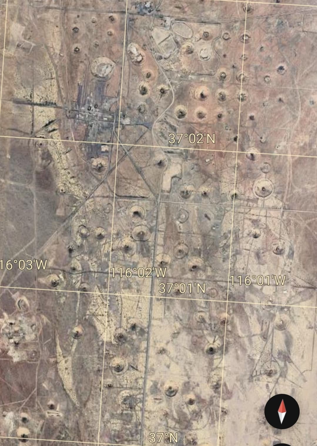
An overhead picture of the Nevada test site, than dark purple spot in southern Nevada. Width of the picture is about 4 km.
15 Likes
It’s lots of intersecting grids and very narrow streets that go nowhere. Also many numbered streets may be reused but don’t actually connect. When I lived in the Bay Area and was trying to get out of San Francisco, I would find that all I generally needed to do was drive east or north and I’d eventually get to a major freeway or thoroughfare that I could use to get to the East Bay where I lived.
In downtown Seattle, I can drive east and end up stuck in a maze that goes above/below/around I-5, but never quite lets me on it. Or worse, I take the wrong on-ramp and end up in an express lane that takes me miles away from where I want to actually go. Constantly changing streets, closures, tall buildings, and detours can also limit the effectiveness of GPS.
Let’s just say, it’s challenging, even for someone like me who’s normally really calm doing city driving. ![]()
10 Likes
You’d think after the 3rd or 4th one they would have been like, “yeah, these work pretty well, wreck plenty of shit, and irradiate everything in their vicinity” and wouldn’t need to keep detonating them.
8 Likes
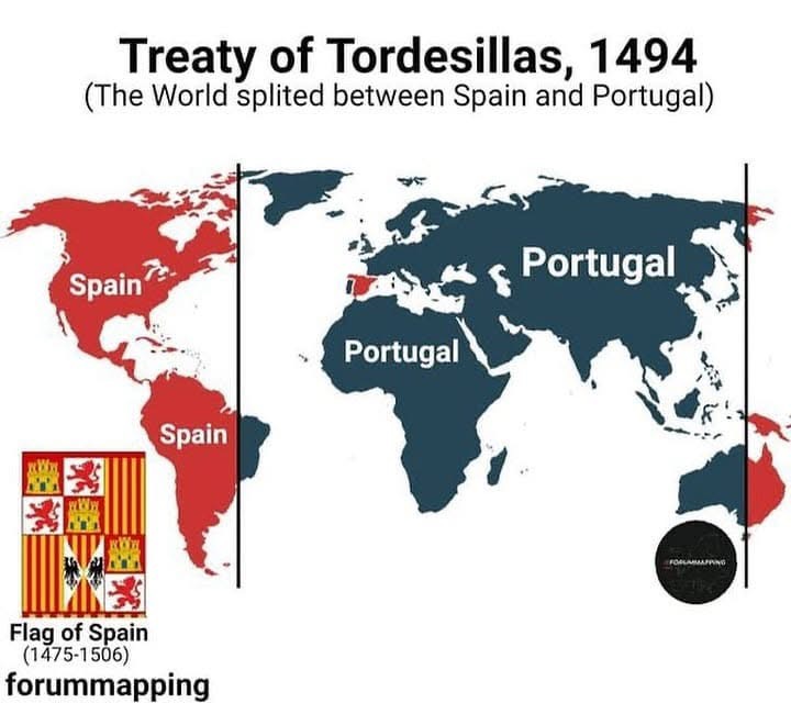
I first heard of this in the Revolutions podcast by Mike Duncan. I’d idly wondered why Portuguese is only spoken in Brazil, but Spanish is spoken in the rest of the continent (more or less).
11 Likes
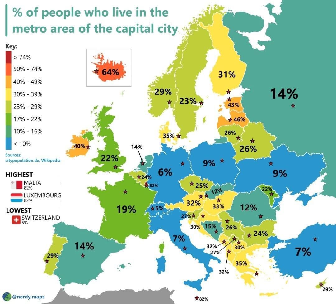
Why hello once almost-neighbour. This son of Viewbank salutes you.
12 Likes
Watsonia represent.
12 Likes
This rang a bell. Seattle, Seattle, I-5, hmm…
Ah, yes. The Union Street exit.
13 Likes
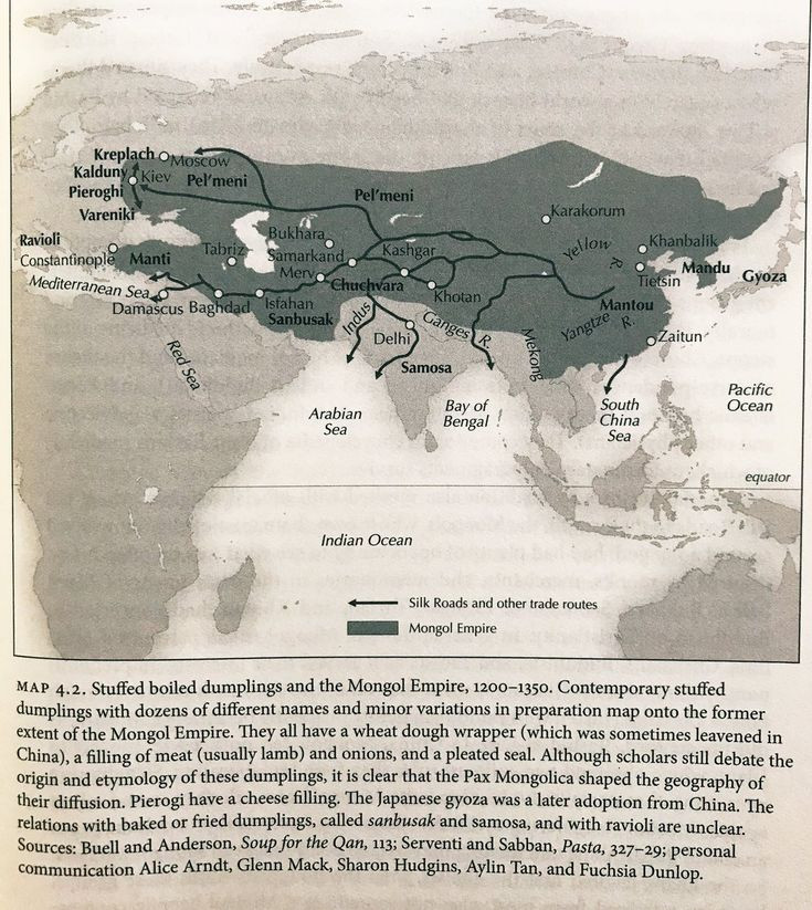
I immediately recognized the Mongol empire on the map, but hadn’t associated it with dumplings!
13 Likes
At least one of those arrows pointing into the Arabian Sea ends up at the East African “sambusa” (usually stuffed with lentils, and as such usually vegan, at least in Ethiopia & Eritrea).
Neither boiled nor fried*, but I figure that empanadas (& turnovers in general) fit in here somehow, as well.
*Now I’m remembering a gluten-free empanada that sure seemed fried… ![]()
8 Likes
As someone who drives through that exit all the time, it’s probably one of the least challenging exits there is in downtown Seattle.
If you want a challenging experience, I recommend WA-520 to Mercer St. This is the exit you’re most likely going to be directed to if you’re wanting to go to the Space Needle from the East Side. It involves a white knuckle slingshot across 4 lanes of heavy traffic in about 1/4 mile. (I’d rather take the later Stewart/Denny exit. It might add about 5 minutes to my trip, but is much less harrowing overall.)
Anyway, back to the Union Street exit. It’s a simple right turn through a tunnel and you’re dumped right on to Union street. From there it’s basically a straight shot to Pike Place Market or a single turn to take you pretty much anywhere you want downtown in short measure.
The problem with this exit isn’t the amount of runway you have before you reach that right turn, which is more than ample.
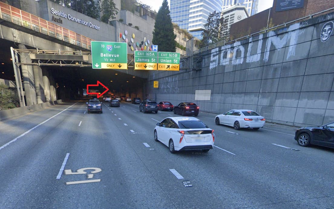
(That red arrow points to whereabouts the right turn is. Also note the sign on the right telling you to slow to 30MPH.)
The problem isn’t with warning signs – there are many. The previous picture which was about 1/4 mile away is telling you to slow to 30. When you get closer, there’s another sign warning you to an upcoming right turn and to slow to 20, and even more signs telling you there’s trouble ahead.
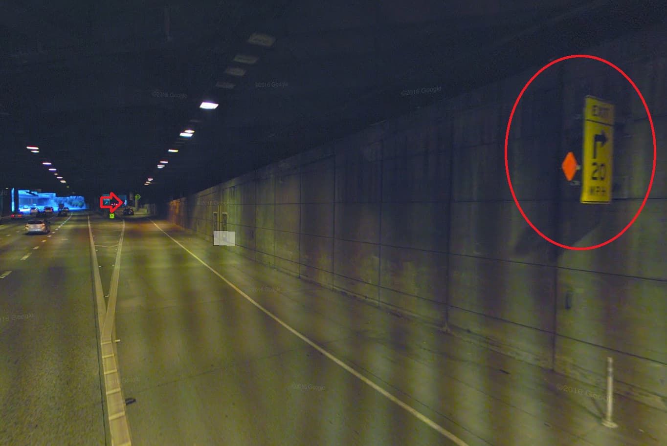
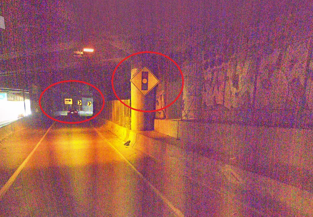
The curve itself isn’t even that severe.
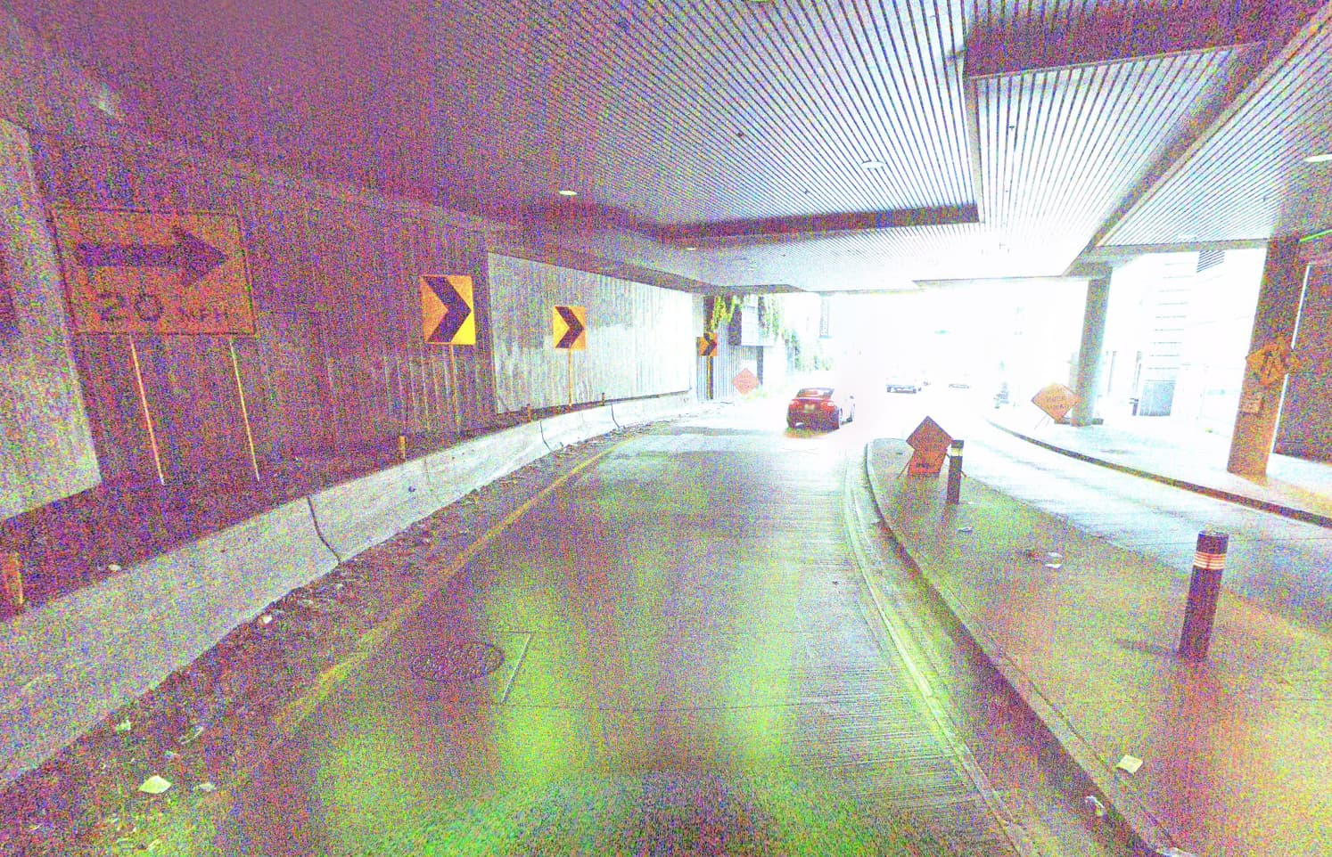
People get into crashes here when they ignore all the signs, warnings, and common sense by taking this exit at entirely too high of a rate of speed. When you come out on the other side, you may end up suddenly transitioning from dry to wet pavement, which is not a good thing at high speeds. But generally the problem is that this dumps you right into a stoplight (that’s usually red), which forces you into some combination of slamming on the brakes, the wall, and/or another car.

By the way, the camera that takes those YouTube videos is positioned right where that arrow is pointing.
15 Likes
Laser height sensor.
8 Likes
man, do i remember that!
coming off the 520, needing to get to the Mercer St. exit, one had to perform “the sweep”. merge, start moving right immediately and slow the fk down for the exit, but this was 35 years ago. back then, i mostly rode my bicycle or took the (fabulous) public bus. then, as a bike messenger in downtown, i knew a bit about getting around town efficiently.
by the way, i lived in Issaquah, and commuted the I90 corridor across Lake Washington and Mercer Island. the round-trip commute was 40 miles. depending on weather, time of night, or how much Red Hook i’d had, i might take the 210 to North Bend, jump off at the Issy park-n-ride, then pedal home.
good times!
edit: add quote from @ficuswhisperer
11 Likes
Hold on.
The line in the Atlantic is 370 leagues west of the Cape Verde Isles and the Azores. The line in Asia is supposed to be 180 degrees opposite the line in the Atlantic. Ptolemy says it is 180 degrees from the Fortunate Isles to China. Therefore, allowing for the shorter degree forther from the equator, the line in Asia would be a couple hundred leagues west of China, and put the Philippenes in Spain.
6 Likes
My family lived in the Seattle area in the 1980s. A life-long resident there told us that the freeways were deliberately designed poorly as a way to reduce traffic. This is either a very dumb conspiracy theory, or a very dumb reality.
10 Likes
![]() was going to suggest, “why don’t they just lower the tunnel?”
was going to suggest, “why don’t they just lower the tunnel?”
12 Likes